Probando la base de datos de cadáveres inmobiliarios en varios mapas

Todavía quedan muchos cadáveres inmobiliarios que adoptar.

Nota: Artículo también publicado en la web de Cadáveres Inmobiliarios.

Se muestran aquí las primeras pruebas que hemos desarrollado desde Montera34 de cara al festival Arquinset 2015 que tendrá lugar en noviembre 2011 con los datos existentes en Cadáveres Inmobiliarios. Esto engloba las bases de datos previas que han aportado diferentes colaboradores y la base de datos de cadáveres inmobiliarios. Los mapas están desarrollados con cartoDB.

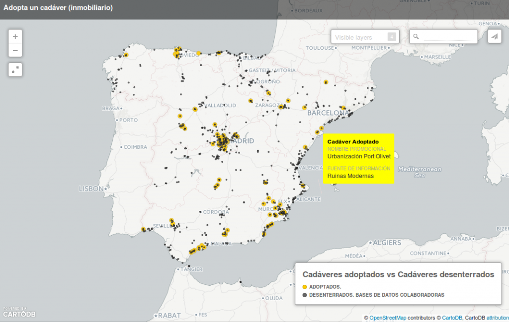
Cadáveres (inmobiliarios) adoptados vs Cadáveres desenterrados


Mirad los puntos negros, que son los cadáveres detectados (“desenterrados”) y los amarillos, que son los cadáveres que han sido adoptados. ¡Aún nos quedan muchos muchos puntos por adoptar!

El proceso de adoptar consiste en ampliar la información de cada uno de los puntos y estructurarla según la base de datos de Cadáveres Inmobiliarios.
Continue reading

How to automate Googlemaps image capture: urban development ruins in Spain

Josh Begley developed a script that outputs a list of googlemaps images given a list of locations (longitud and latitude needed). It runs in Processing and uses the Google Maps API. It was originally used to get aerial images of all the prisons in the USA. I thought it could be interesting to get googlemaps images from all the urban developments that were built and unfinished during the real estate bubble in Spain. I’ve opened a spreadsheet http://bit.ly/listapaus with a few of them to test the script.

This is a side project to the 6.000km map, a kind of wiki to collect info about urban metabolism in the era of the real estate bubble in Spain. Soon, we will have updated photos of some of these places, that we just took in Madrid with balloon mapping techniques.

Continue reading